There are geographical regions characterized by their relatively small size but exceptionally valuable location (“increased positional rent”) and distinctive past (“an excess of history”). Usually, these features are accompanied by a heterogeneous ethno-religious structure, a highly sought-after natural resource, and an atypical political-territorial status. Such regions have always carried particular geopolitical “specific weight” and exerted a pronounced “magnetism” on great powers.
Consequently, they generally represent a persistent military and security challenge and possess considerable conflict potential. When the global pieces fall into place, such regions become targets of armed aggression or ideal settings for false flag operations. An attack on them can easily be declared a casus belli and become the trigger for armed conflict on a broader scale—regional or even global. In the context of the traditional antagonism between the West and Russia, particularly the ongoing armed conflict in the Ukrainian theatre, the Kaliningrad Region undoubtedly fits this description.
FROM PRUSSIA TO A RUSSIAN REGION
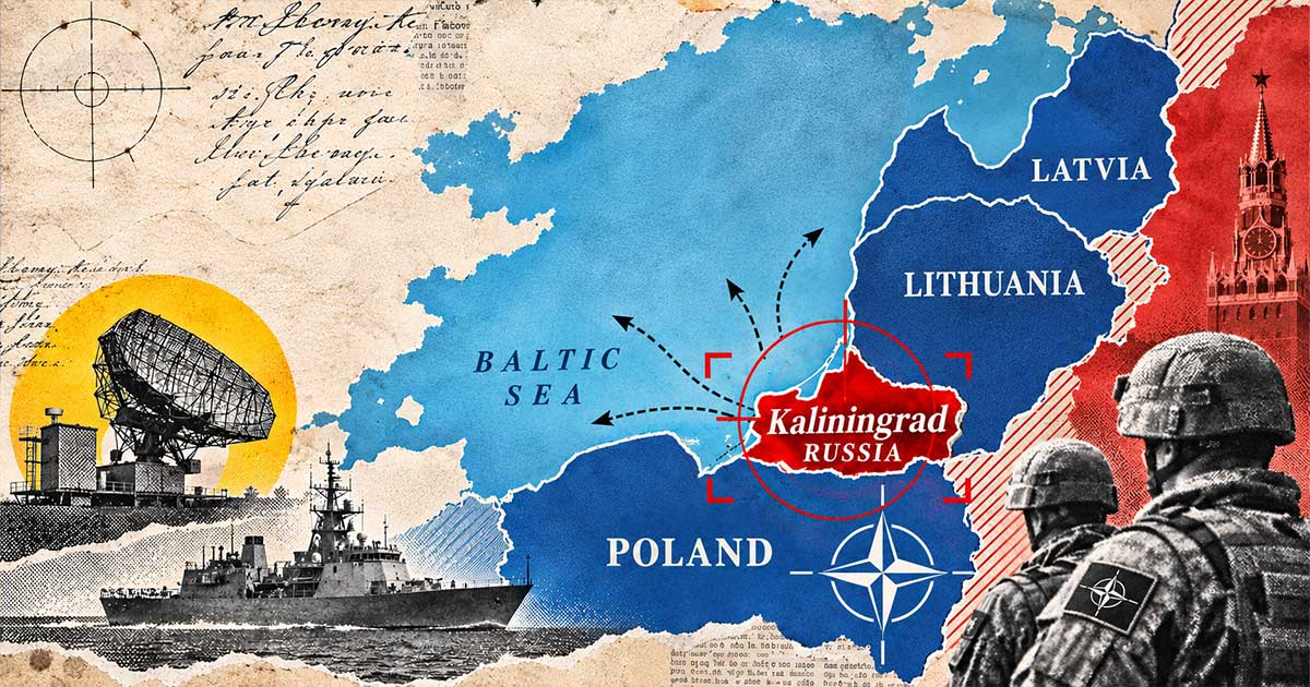
The Kaliningrad Region is one of the 89 federal subjects of the Russian Federation, holding the status of an oblast—the second-highest administrative status, immediately below that of the republics. It is Russia’s westernmost administrative-territorial unit, an exclave entirely separated from the bulk of Russian territory but an integral part of the Russian state. It is connected to mainland Russia by sea, through the Baltic Sea and its Gulf of Finland, which links it to Leningrad Oblast and the federal city of Saint Petersburg. Lithuania and Belarus, or alternatively Lithuania and Latvia, separate it from the rest of Russian territory.
In this context, the Suwałki Corridor is of paramount importance. It separates the Kaliningrad Region from Belarus, Russia’s most loyal ally, while also connecting Poland and Lithuania. It is 65 kilometres wide as measured in a straight line, while the Polish-Lithuanian border is 104 kilometres long. Key existing and planned infrastructure routes and geostrategic axes run through it. The corridor connects the “torso” of the EU and the European part of NATO with their northeastern Baltic panhandle, making it particularly vulnerable to being cut off. At the same time, transit links between the Kaliningrad Region and Belarus/Russia, previously regulated by agreements, have largely been severed or severely restricted as a result of strained relations between Russia and the West and the Ukraine crisis. The Suwałki Corridor is therefore justifiably regarded—and colloquially referred to—as a “geostrategic umbilical cord,” a “danger zone,” an “Achilles’ heel,” a “hot corridor,” and even “the most dangerous place in the world,” where a direct NATO–Russia confrontation could erupt.
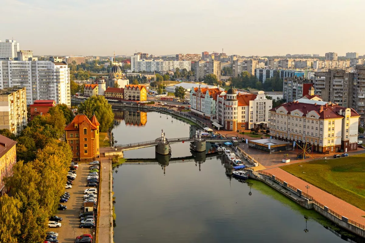
How did the Kaliningrad Region emerge from the northeastern part of historical-geographical East Prussia? It arose from the defeat of Nazi Germany and the contraction of its territory. It thus became “war booty” for the victorious Soviet Union, meaning that it was incorporated into Russia, one of the Soviet Union’s 15 constituent republics. In 1946, its central city, Königsberg—where the renowned Immanuel Kant was born, spent his entire life, developed his ideas, and wrote his works—was renamed Kaliningrad after Mikhail Kalinin, one of the Bolshevik leaders. The entire region subsequently took the same name.
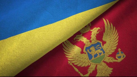
The Kaliningrad Region covers an area of 15,125 square kilometres. For comparison, it is slightly larger than Montenegro. Of the region’s population of just over one million, approximately half live in the regional capital itself. The landscape consists of gently rolling plains of glacial origin. The region is known as the “Amber Coast” because it contains 90 per cent of the world’s amber reserves (known in Russian as yantar)—the “Baltic gold.” Its foremost geopolitical and geostrategic asset is its forward position toward the West, which “breaks through” the territorial continuity of the EU and NATO. In addition, it borders the open waters of the Gulf of Gdańsk in the Baltic Sea, giving it an advantage over Russia’s presence in the vulnerable Gulf of Finland, which is susceptible to blockade.
FROM DECLINE TO RISE
Much like the case of the Socialist Federal Republic of Yugoslavia, where internal borders were deceptively presented under Tito as “lines carved in granite,” the fact that the Kaliningrad Region had no territorial continuity with Russia was not considered important. That remained the case until the disintegration of the USSR. The weakened Russia of that era was unable to prevent various forms of widespread social pathology from taking root in this detached part of its territory: oligarchization, organized crime, systemic corruption, drug addiction, prostitution, smuggling of all kinds, and more. This was the price of the “greatest geopolitical catastrophe of the 20th century” (Putin).
In the West, particularly in a strengthened and revanchist-minded Germany, “mouths began to water.” The appetite was anti-Russian and expansionist. Prussian-nostalgic and pan-German ideas were increasingly openly promoted, advocating the separation of the Kaliningrad Region from Russia, emphasizing its supposed “European character” derived from the legacy of Königsberg and Kant, its return to the “motherland” of Germany, and even the establishment of a “fourth (independent) Baltic state” alongside Lithuania, Latvia, and Estonia. Naturally, its task would be to further block Russia’s access to and influence over the Baltic Sea.
Russia reacted sluggishly, but ultimately adequately and without an irretrievable delay. It designated the entire Kaliningrad Region a Special Economic Zone, introducing a series of incentives intended to mitigate the consequences of isolation and strengthen its ties with the rest of Russian territory. It subsidized maritime freight transport, supported domestic entrepreneurs through tax breaks and reduced social contributions for employees, and significantly accelerated administrative procedures through decentralization.
At the same time, Russia substantially developed its military-industrial complex, which acted as a driving force for other branches of the economy. It also succeeded in ensuring that the energy sector—particularly electricity and liquefied petroleum gas supplies—operated reliably and with complete autonomy, even under conditions of isolation. Moreover, on Kaliningrad’s eastern outskirts, on Oktyabrsky Island in the river near the confluence of the Pregolya River and the Vistula Lagoon, Russia established a “domestic offshore zone,” granting preferential treatment to companies repatriating capital previously transferred abroad. All of this—naturally, before the conflict on the Ukrainian stage—attracted even Western foreign investment. At the time, the Kaliningrad Region was regarded as “Russia’s new window to Europe,” in a parallel with Saint Petersburg.
RUSSIA’S WARNING TO THE WEST: DON’T POKE THE HORNET’S NEST!
The coastal sector of the Kaliningrad Region is geographically distinctive and of considerable geostrategic importance. It consists largely of two major lagoons separated from the open sea by long, narrow sandy spits, known as barrier spits or lidos. One of them is the Vistula (Baltic) Spit, which encloses the lagoon of the same name (the Kaliningrad Lagoon) and separates it from the open sea, namely the broad Gulf of Gdańsk. The Russian-Polish border runs across the spit, simultaneously marking the border between the EU/NATO and Russia. The Vistula Lagoon covers an area of 838 square kilometres, of which 56 per cent belongs to Russia, specifically the Kaliningrad Region, while the remainder belongs to Poland. The lagoon is naturally shallow, reaching a maximum depth of just five metres, but a shipping channel leading to the port of Kaliningrad is dredged to a depth of 10–11 metres, making it navigable for larger seagoing vessels.
The Kaliningrad section of the Vistula Spit is cut through by a single channel, approximately 400 metres wide, bordered by reinforced banks and breakwaters, marked with navigational aids, and regularly dredged and maintained. It represents a “bottleneck” for civilian commercial maritime traffic and the unhindered movement of the Russian Navy’s Baltic Fleet, headquartered at the nearby, well-equipped naval base in Baltiysk, within the lagoon. This is a vulnerable point that would undoubtedly be targeted at the very outset of any potential armed conflict. If the channel were obstructed, the Baltiysk base would be blockaded. Russian warships—if they remained inside the lagoon, which would be an amateurish mistake—would become easy targets for NATO attacks. Russia’s role in the “bottle” of the Baltic Sea, already constrained by the Skagerrak and Kattegat straits, which are not under Russian control, would be reduced to a minimum.
Evidence of the area’s former military significance can be found in the fact that, between 1934 and 1939, the Germans built a highly modern military airfield for the Luftwaffe on the Vistula Spit itself. Known as Neutief, it had two concrete runways whose surfaces could be heated during the winter. The Nazis made little use of it, although the Allies bombed it, and the Soviets used it for a period during the Cold War. It is now abandoned, though not entirely unusable in the event of a conflict. Further confirmation of the area’s present-day significance is Poland’s recent construction of a canal through its section of the Vistula Spit. This has enabled seagoing vessels to reach the port of Elbląg and, amid strained relations between Poland (the EU/NATO) and Russia, eliminated the need for Polish vessels to depend on passage through the Russian canal. Another development worth noting is the construction of an artificial island, approximately two kilometres by one kilometre in size, in the Polish part of the lagoon, officially justified, as emphasised, on “security grounds.”
Today, the Kaliningrad Region is armed “to the teeth” and is considered one of the most heavily militarised and most hazardous regions in Europe. Inland lies the Chernyakhovsk Russian air force base, with a 2,500-metre runway. On the Baltic coast is the Donskoye base, with a short runway measuring 500 metres, while northwest of the regional capital is the Kaliningrad-Chkalovsk naval aviation base, with a 3,500-metre runway. Nearby is Khrabrovo International Civil-Military Airport, whose runway is 3,350 metres long. Numerous other military installations are scattered throughout the region, ranging from early-warning radar systems to launch systems for the most advanced missiles, with varying destructive power and ranges, capable of carrying conventional or nuclear warheads.
The current number of troops and military personnel is difficult to estimate because of the redeployment of forces and the replenishment of troop numbers on the Ukrainian battlefield. Nevertheless, it is evident that previously smaller formations are being transformed into larger ones, while continuous mobilisation and tactical assessments, exercises, and training are being conducted to test and improve their capabilities. The technical outfitting and modernisation of these forces to prepare them for new forms of warfare go without saying.
And all of this is more or less what is publicly known—the tip of the iceberg! In military and geostrategic terms, the Kaliningrad Region is a “hedgehog with its spines raised” and “Russia’s western fortress.” It is therefore hardly surprising that official Moscow has warned that, in the event of an attack on the region, Russia would use “every weapon at its disposal.”